I-65 North Overlay District Map
![]() Watchdog Indiana Home Page
Watchdog Indiana Home Page
![]() Watchdog Lebanon Home Page
Watchdog Lebanon Home Page
![]() I-65 North
Overlay District Special Report
I-65 North
Overlay District Special Report ![]() I-65
North Overlay District Document
I-65
North Overlay District Document ![]() I-65
North Overlay District Land Owners
I-65
North Overlay District Land Owners ![]() I-65
North Overlay District Land Owner Questions
I-65
North Overlay District Land Owner Questions
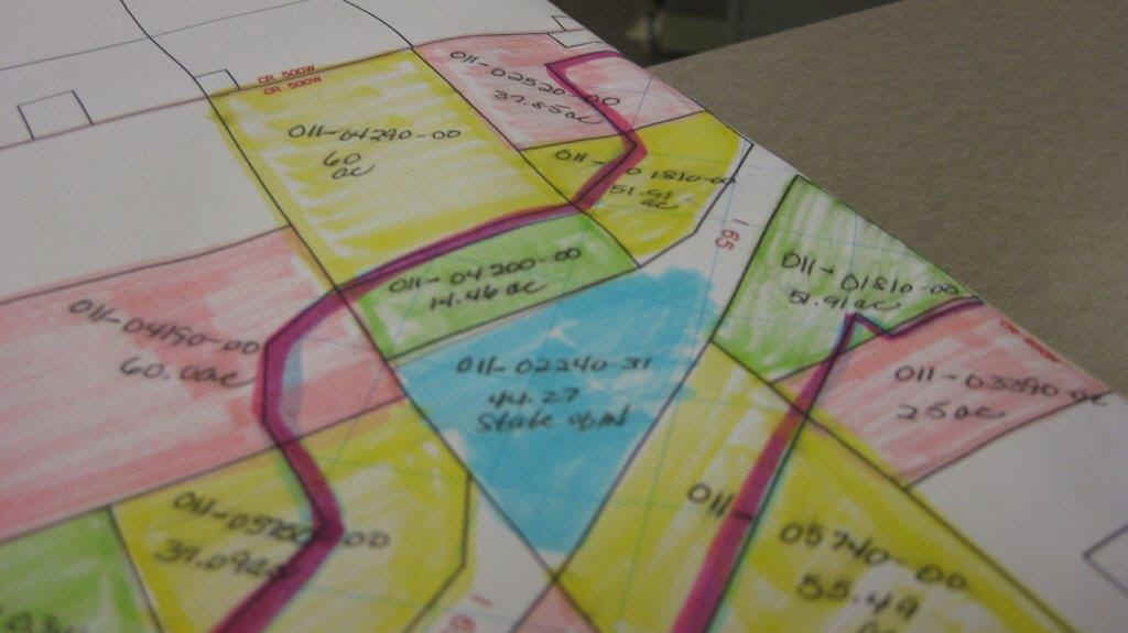
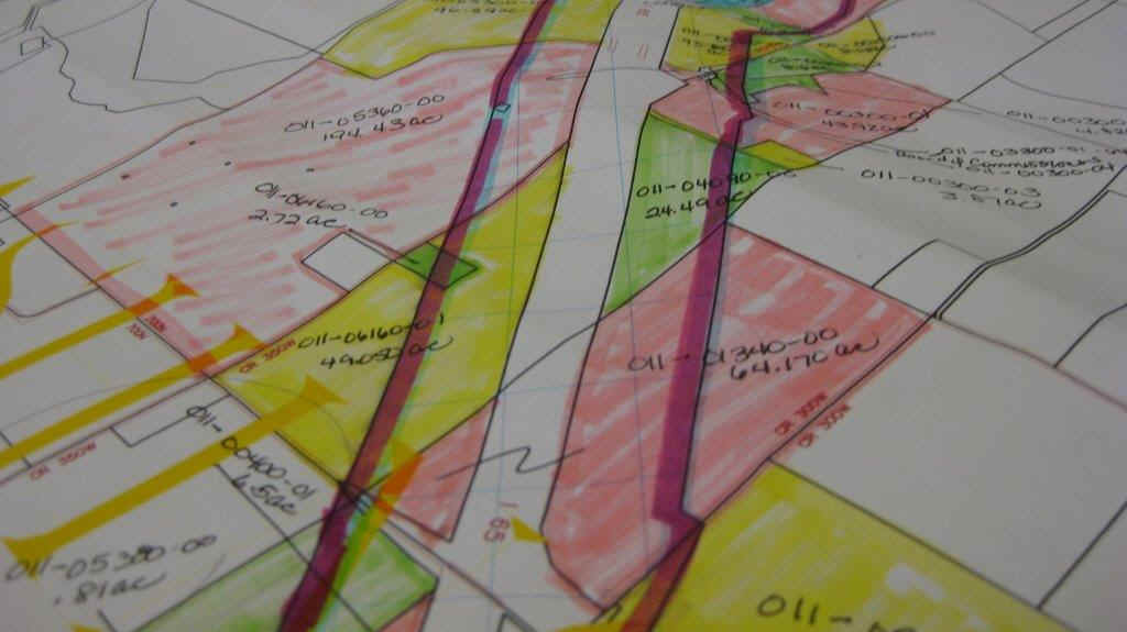
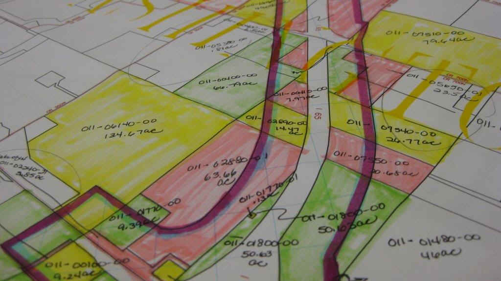
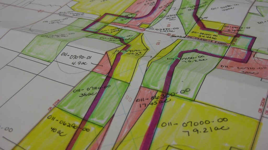
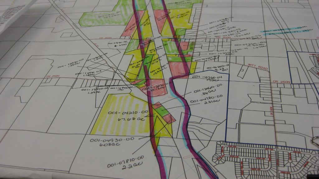
NOTE: The Boone County Area Plan Commission (APC) has steadfastly refused to post the map of the proposed Overlay District on its website. The pictures below of the Overlay District map were taken in the APC office on August 9, 2013. Lines on each side of I-65 that are 600 feet away from the I-65 right-of-way (highlighted by the dark pink color in the pictures below) determine which land parcels are included in the proposed Overlay District adjacent to the I-65 North Corridor. If any part of a land parcel is touched by a 600-foot line, then the ENTIRE parcel is included within the proposed Overlay District. Some might wonder if the APC is reluctant to post the Overlay District map on its website because it vividly demonstrates how much land is included in the proposed Overlay District. The land captured within the proposed Overlay District (which has been described as a "pittance" by a pro-development advocate) totals 3,776.97 acres, which is more than the 3,675 acres included within the 2009 Lebanon I-65 South Corridor annexation.
I-65 at the Clinton County line:
I-65 north of where County Road 850 N crosses I-65 to the Clinton County line.
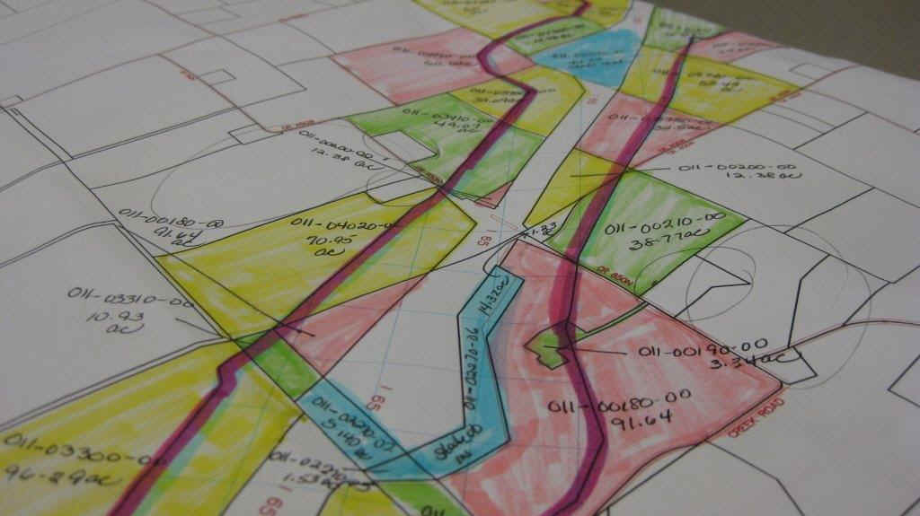
I-65just north of where County Road 700 N crosses I-65
I-65 just north of the State Route 47 and I-65 intersection:
I-65 just south of the State Route 47 and I-65 intersection:
I-65 at the Center Township and Washington Township boundary line:
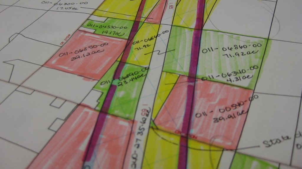
I-65 just north of County Road 300 N:
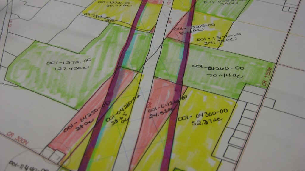
Intersection of US 52 and I-65 just north of the Lebanon city limit:
![]() Watchdog Indiana Home Page
Watchdog Indiana Home Page
![]() Watchdog Lebanon Home Page
Watchdog Lebanon Home Page
![]() I-65 North
Overlay District Special Report
I-65 North
Overlay District Special Report ![]() I-65
North Overlay District Document
I-65
North Overlay District Document ![]() I-65
North Overlay District Land Owners
I-65
North Overlay District Land Owners ![]() I-65
North Overlay District Land Owner Questions
I-65
North Overlay District Land Owner Questions
This page was last updated on 08/21/13.